Arctic sea ice ties for tenth-lowest summer minimum on record
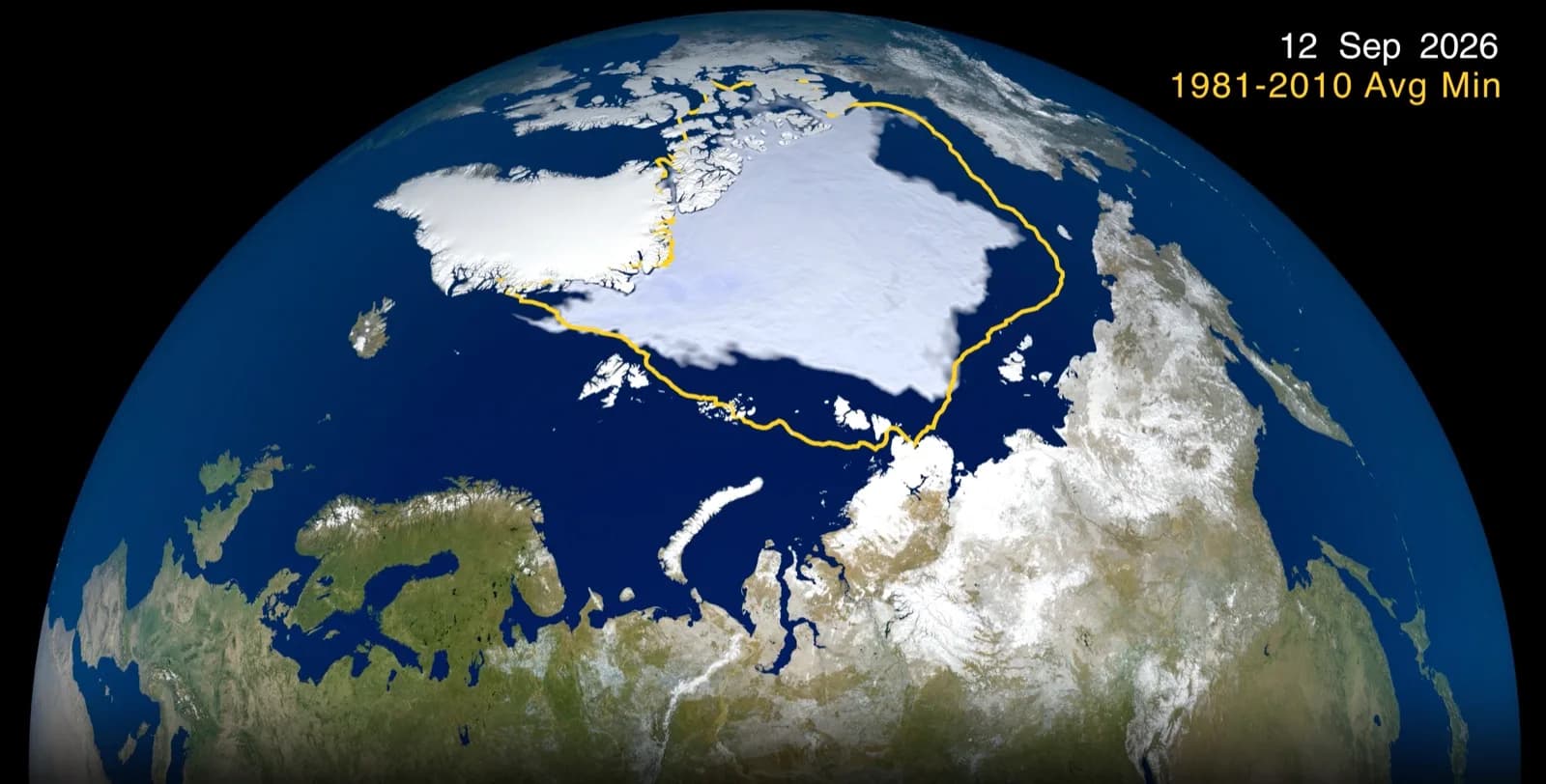
NASA and NSIDC estimate Arctic sea ice reached 4.6 million square kilometers on September 12, tying three other years for tenth lowest in the satellite record.
OddBrief EditorialAI-assisted, human-reviewed
 Science
Key facts
- Minimum
- September 12, 2026
- Extent
- 4.6 million square kilometers
- Rank
- Tied for tenth-lowest with 2008, 2010 and 2025
- Record
- Continuous satellite observations since late 1978
- Caveat
- Extent is not ice thickness or volume
Arctic sea ice shrank to an estimated 4.6 million square kilometers on September 12, its annual minimum for 2026, according to NASA and the National Snow and Ice Data Center. The result ties 2008, 2010 and 2025 for the tenth-lowest minimum since continuous satellite measurements began in late 1978. It is a single season’s measure, but it sits within a long record of unusually low summer ice.
What the ranking measures
The minimum is the point at which the area of ocean covered by sea ice stops shrinking after the Arctic summer and begins to grow again. NASA and NSIDC use satellite observations to estimate its extent, which is different from the ice’s thickness or total volume. A map of extent can show how far the ice reaches; it cannot by itself tell the full story of how much ice remains or how resilient it is.
The past 20 years, from 2007 through 2026, produced the 20 lowest annual Arctic minima in the satellite record, NASA reports. This year did not set a new record low. That does not cancel the longer pattern. The comparison is a useful reminder that a climate trend and a single weather-influenced year answer different questions. A ranking can move up or down even when the multidecade picture remains clear.
Why one summer can look different
Sea ice grows through the dark, cold months and retreats in spring and summer. Cloud cover, winds and other weather conditions can change the amount that melts in a given season. NASA cites scientists who say more cloud cover over the last decade has, at times, limited the extra solar energy reaching the ice. That has contributed to a relatively stable run of recent September extents, although those extents remain low compared with the earlier satellite record.
The agency also notes an unusual six-day drop in Antarctic sea ice of about 300,000 square kilometers during August before growth resumed. Researchers suspect weather pushed and compacted thin ice at the edge. Antarctica is a different system: ocean surrounds the continent, leaving ice more exposed to wind and year-to-year swings. NASA and NSIDC have not yet confirmed the 2026 Antarctic annual maximum, so it should not be folded into the Arctic result.
A record kept across satellites
NASA and NOAA have maintained the polar sea-ice record through a succession of instruments, beginning with Nimbus-7 in 1978. Current estimates rely on the Advanced Microwave Scanning Radiometer 2 aboard Japan’s GCOM-W satellite. Keeping a continuous series matters because the significance of one season emerges from consistent comparisons across decades.
The 2026 Arctic minimum shows a summer that was not the most extreme, yet still among the lowest measured. The next question is how the ice regrows through winter and what future observations reveal about its thickness, age and stability.
Sources
- Arctic Sea Ice Reaches 2026 Annual Minimum ExtentNASA Scienceprimary source